
 |
INTRODUCTION TO UNIT Target Grade Level: This unit assumes students know the "basics" about the Lewis and Clark expedition and the historical background on the Corps of Discovery's journey, as well as some knowledge of the American Indians they meet on the journey. Such information serves as necessary context. Students will learn that there are different mapmaking traditions from their own and that one can begin to better understand one's own culture as well as others through maps. Through an examination of a historic document and contemporary interviews, students will examine differing conceptions of the land and man's relationship to it. Please note this is not a unit on how maps were made by Lewis and Clark. Its focus is not the process of mapmaking but rather maps as cultural artifacts. Explore Connections to Today for this unit. MAJOR UNDERSTANDINGS Maps and historical documents are created within a cultural tradition and present a glimpse into the culture that created them. Maps tell us not just what is being mapped but also a great deal about the mapmaker. ESSENTIAL UNIT QUESTIONS
KEY KNOWLEDGE OBJECTIVES Students will:
KEY SKILL OBJECTIVES Students will:
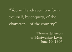
FORMATIVE ASSESSMENT SUGGESTIONS Throughout the lessons, look for students' ability to generate ideas/concepts that reflect their existing knowledge of a map's elements. Check to see that as the lesson progresses, students understand that differences in mapmaking are reflections of a culture. Assess the extent to which students understand that Jefferson's instructions represent a different view of the land (i.e., something to be possessed and controlled) from the American Indian view. Jefferson saw the land as empty, waiting for American emigration, as opposed to the American Indian view that the land was given to them and was the space where ceremonies and other major events in their history took place. Check to see that students record data and ideas in their journals throughout the lessons.
|
|||

 |
 |
 |